Recent content by Johnny D
-
J
E30Z camera
- Johnny D
- Post #32
- Forum: H520 Discussions
-

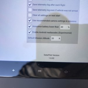
F814D683-A0B8-46DF-AFAB-06CCD78A4396.jpeg
Firmware- Johnny D
- Media item
- datapilot firmware
- Comments: 0
- Category: Example category
-

45B1F785-24C2-4FDC-9547-C62BE29EDE91.jpeg
Firmware- Johnny D
- Media item
- datapilot firmware
- Comments: 0
- Category: Example category
-
J
H520 import shape files from GIS into datapilot
I believe you are correct I haven’t had much time on the equipment yet but certainly a good point the other alternative cameras will need to be purchased to actually do the job correctly. I believe it’s the other Yuneec E90 if I’m not mistaken. Thank you for your information as Well.- Johnny D
- Post #11
- Forum: H520 Discussions
-
J
H520 import shape files from GIS into datapilot
Thanks for all the information, going to get familiar with all the bells and whistles on the default application that came with the drone before implementing other software. We have “The E30Z for the YUNEEC H520 Hexacopter is a powerful 30x zoom drone camera and makes it easy to zoom in on...- Johnny D
- Post #9
- Forum: H520 Discussions
-
J
H520 import shape files from GIS into datapilot
Thanks looking into it Mission Planner Overview — Mission Planner documentation So this is a third party that Yuneec H 520 can use?- Johnny D
- Post #7
- Forum: H520 Discussions
-
J
H520 import shape files from GIS into datapilot
KML or Line shape can import line shp to MissionPlaner software and save mission as .waypoint or .plan that is readable by QGC. Just didn't know if I use offline map function or is there an import command or drop down cant seem to find the process in Data Pilot to import these items. Is there...- Johnny D
- Post #5
- Forum: H520 Discussions
-
J
H520 import shape files from GIS into datapilot
Not sure we just picked up this equipment Yuneec H520 and using Data Pilot. I'm a novice for sure. I can use CAD GIS and survey Software Leica Zeno 20. So any interactions would be awesome with this Yuneec System from controller.- Johnny D
- Post #3
- Forum: H520 Discussions
-
J
H520 import shape files from GIS into datapilot
Has anyone used CAD files or GIS shape files base maps to create way points for autonomous flights like for survey or Pole line inspections? Question would be importing the data to create way points.- Johnny D
- Thread
- Replies: 11
- Forum: H520 Discussions


