Working for a large utility we jumped on these as soon as they came out to add to our H. After a few flights in the field we have concluded that it's good for doing a quick investigation, but does not provide the necessary information to make a decision on criticality of an issue. A follow-up with a higher end IR tool would be required if anything was observed to be "hot"
The CGO-ET only produces analog imagery and doesn't allow you to post-process the image using IR software. This means you have to set all of your IR parameters (Emissivity, humidity, distance, reflected temperature, etc...) in flight. Once those parameters are set, it's still difficult to get the gimbal stay centered on the object to get a temperature reading.
An interesting note is how the images are stored. On-screen you can have the overlay of IR and visual which provides a nice view of what you're looking at. When you save an image you get 3 images on the SD card as well as a screenshot on the ST16 (internal storage, not SD card for some reason). The 4 total images that are saved are:
SD Card
- 1920 x 1080 visual .jpg - no GPS information is stored in the EXIF data
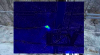
- 160 x 120 IR .jpeg file - this is the analog IR capture from the sensor. the EXIF data does indicate the "centre temperature" in degrees C (even though the controller was set to imperial and shows degrees F). Again no GPS in this files EXIF data.
- 160 x 120 IR .tif file. For some reason the .tif file comes out as all black. The EXIF reports the same centre temperature but this file does include GPS info.
ST16
- 1057 x 590 .png file with a non-matching file name to the SD files - this is a screenshot of the IR / Visual overlay from the controller.
Again, none of these files is able to be read by any IR processing software, and the exif data does not have the calibration information (I.E. the image is non-radiometric). I confirmed this with Yuneec customer support, who indicated you "may be able to extrapolate based on the color gradient" confirming they knew nothing about Infrared Thermography. Also the scale isn't present in any of the imagery so even that would be futile.
See attached for some imagery. I had to put the visual and IR image into a zip file because they would not upload (not a recognized image file error). In my honest opinion, Yuneec has a long way to go with this if it's meant to be used for commercial or industrial inspection purposes. For a quick view of roof/housing insulation or hobbyist use the CGO-ET seems to be an expensive nice to have.