Hello Fellow Yuneec Pilot!
Join our free Yuneec community and remove this annoying banner!
Sign up

E30z

Impressive clarity and pitch control at that distance. If you launched from either of the open lots adjacent to your map point, that steeple is ~ 2.75Km (~1.75 miles) away. Wow.
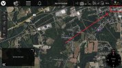
I looked on google maps to determine the distance. Can I do it via the controller? So if I say picked the position it’s flying and set a marker on the church would it tell the distance. The picture up to 30x optical does seem pretty good but I think it’s in 1080p and not 4k. When u reach the full 30x optical it seems to do a 6x digital zoom if u try to zoom further, the digital doesn’t seem as clear. It gets a bit of a shake on the image at full zoom but still pretty good for the windy conditions here, I’m looking forward to a nice warm summers day to try it without the wind
 
There is the on-screen scale in the upper right corner that can provide at least a rough estimate.
Someone else may know a better way.
View attachment 31661
Ahh lovely , I didn’t notice the distance up at that top corner , hence the google maps. Next flight I’ll try determine the max distance it can view that still will fit a complete building in frame. I’m thinking maybe 4km would be pushing it’s useful limits.
 
  • Like
Reactions: WTFDproject
Ahh lovely , I didn’t notice the distance up at that top corner , hence the google maps. Next flight I’ll try determine the max distance it can view that still will fit a complete building in frame. I’m thinking maybe 4km would be pushing it’s useful limits.
Please understand it is a scale, not a meter or direct measurement. You have to adjust your screen until both flight position and target are on screen at the same time, then judge how many multiples of the scale will fit between your target and flight position on the screen.
I tried it on your steeple locations. Trust me, it was about a million times easier to look it up on GoogleEarth.😕
😅, I taught I might have went about it an awkward way.
Please understand it is a scale, not a meter or direct measurement. You have to adjust your screen until both flight position and target are on screen at the same time, then judge how many multiples of the scale will fit between your target and flight position on the screen.
I tried it on your steeple locations. Trust me, it was about a million times easier to look it up on GoogleEarth.😕
i was thinking I did it the most awkward way 😅. I wasn’t to interested in the distance myself, I just taught if I’m going to add a post I’d better give some context on what people were viewing. I must get some footage of my hometown here versus the town im in now, we have some beautiful views about the cost
 
  • Love
Reactions: WTFDproject

Members online

Forum statistics

Threads
21,327
Messages
245,653
Members
28,262
Latest member
kybelvody