Hello Fellow Yuneec Pilot!
Join our free Yuneec community and remove this annoying banner!
Sign up

Flyaway

@jamesj91384
Please follow the steps in this video to recover the flight log files. Upload the zip file directly to this page as you did with the other zip files.
To view this content we will need your consent to set third party cookies.
For more detailed information, see our cookies page.
 
  • Like
Reactions: Chris Koch
@jamesj91384
Please follow the steps in this video to recover the flight log files. Upload the zip file directly to this page as you did with the other zip files.
To view this content we will need your consent to set third party cookies.
For more detailed information, see our cookies page.
Steve, I need to get a SD card and card reader adaptor for MAC, the only SD card I had was in my drone. Will do ASAP.
thank you for helping.
 
  • Like
Reactions: Steve Carr
The simplest way is to use an SD card but with some luck, your computer will recognize the controller. Any SD card with the FAT32 filesystem can be used in the controller.
 
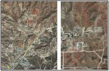
Kind of an "off the wall" thing, but can you mark this image to show the approximate direction the drone travelled after losing control? Can you estimate how high above ground level it was?
View attachment 27713
I would estimate the elevation was 200-250 feet. I got on the roof to try and get reconnected and to have a better view of drone.
 

Attachments

Not good. The direction it traveled suggests it would have travelled a couple of miles before encountering land high enough to stop it. At that distance the chances of it staying on course are not good. Using the estimated height and direction would yield the two areas marked in red as the general search area. Not really much hope in this, but it's all I have at the moment. Maybe better if we can get the flight logs to narrow down the path as far as telemetry held up.
Rough Search Area.jpg
 
A comment from the peanut gallery to jamesj - Go in to your controller and make sure you have the correct date and time. My Typhoon H controller will frequently default back to some earlier date and time. Files will then be marked with the incorrect date and time.
 
A comment from the peanut gallery to jamesj - Go in to your controller and make sure you have the correct date and time. My Typhoon H controller will frequently default back to some earlier date and time. Files will then be marked with the incorrect date and time.
If you have good GPS data it should change to the correct date and time (standard as GPS does not use daylight savings), but easy enough to check beforehand. I believe it is the GPS on the ST16 that is used, but I could be wrong.
 
I believe it is the GPS on the ST16 that is used, but I could be wrong.
You're right. The copter doesn't know about the clock time at all. The camera uses the time from the ST16. Still didn't check how often it is updated.
 
The only time any of my ST16's update the time and date is when I connect them to the wifi router. I don't recall them ever updating on their own in the field.
 
Try to set the time with a few minutes difference from the real one and after that check what happens with a GPS coverage for ST16. Sometime before I tested this and it works. The problem with the ST16 is a chaotic selection of timezone and daylight savings time. This is a known problem, which reflects the time of the taken pictures too. A year ago I was found a balanced solution, now I'm not flying active, so should reconstruct it to the spring.
 
  • Like
Reactions: Steve Carr

Members online

Forum statistics

Threads
21,327
Messages
245,653
Members
28,262
Latest member
kybelvody