Hello Fellow Yuneec Pilot!
Join our free Yuneec community and remove this annoying banner!
Sign up

H520E differences from H520

I imagined that this amount of zoom would cause that. Is this even with the gimbal yaw adjustment knob? Maybe a shortcut to cut the action in half?

Yes, even with the knob. It may be possible to alter the ST16S response curves, but I'd rather see Yuneec take care of it. Perhaps an automatic change when the E30ZX is recognized. Also, apparently no on-screen zoom amount indicator, although that info is recorded in pic frames.

The stability of the system is amazing, even in light winds.
 
looks like 2nd gen h520 must have a payload attached. 1st gen you clould fly with out payload just no battery info or telemtery. I will be looking into more to see if i can fly the 2nd gen h520 without payload.
 
Great thread guys - Regretfully the range is a giant stop sign for myself and others - not because anyone needs more than a 1/2 mile but when you have good range it keeps the drone in the air during interference. The new DJI FPV drone now uses DJI's new Ocusync 3.0 with up to 6.2 mile of range.

does anyone know the nit brightness of the ST display!

Stay Safe - Mike
 
  • Like
Reactions: Rayray
Great thread guys - Regretfully the range is a giant stop sign for myself and others - not because anyone needs more than a 1/2 mile but when you have good range it keeps the drone in the air during interference. The new DJI FPV drone now uses DJI's new Ocusync 3.0 with up to 6.2 mile of range.

does anyone know the nit brightness of the ST display!

Stay Safe - Mike
I am in the U.S. and personally I have never had an issue with even the original H520 breaking flight or a mission when operating within the FAA VLOS regulations. For those needing clarification this means that you need to be able to navigate the drone visually by understanding its orientation, not just seeing a dot in the sky. With the improvements to the radio systems on the E model I cannot foresee any legal operation in which it would be a problem.
 
does anyone know the nit brightness of the ST display!

Stay Safe - Mike
I'm thinking the ST16S in outdoor setting is 500. My experience is that a sun shield is still handy in bright sun.
 
I am in the U.S. and personally I have never had an issue with even the original H520 breaking flight or a mission when operating within the FAA VLOS regulations. For those needing clarification this means that you need to be able to navigate the drone visually by understanding its orientation, not just seeing a dot in the sky. With the improvements to the radio systems on the E model I cannot foresee any legal operation in which it would be a problem.
500 nits and I always run the sun shade. Besides my safety vest glare it really not good to have constant direct sunlight on an LCD. The battery life is already short enough so it is what it is.
 
Well I do have a old modified st16s battery that was converted to using old h480 st16 batteries on the h520. I might do further modifications to enable larger single cell external batteries with the correct voltage and amps just much more capacity. and not run a jumper pack from the st16s st16e charging usb jack. With the proper electronic circuitry to reduce voltage and amperage to the correct power requirements how long can the st16s or st16e run for on a stable clean power from a auto rv deep cycle battery
 
Well I do have a old modified st16s battery that was converted to using old h480 st16 batteries on the h520. I might do further modifications to enable larger single cell external batteries with the correct voltage and amps just much more capacity. and not run a jumper pack from the st16s st16e charging usb jack. With the proper electronic circuitry to reduce voltage and amperage to the correct power requirements how long can the st16s or st16e run for on a stable clean power from a auto rv deep cycle battery
The worst part is that is has to be the inefficiency of the hardware and radio. The batteries are 8700mah and should last much longer than 1.5 hours. For example a P4 Pro battery is only 6000mah and I can operate more than 2 hours to 50%.

From what I was told by the engineers we worked with on the beta it is not recommended to use the device and charger at the same time. The circuitry is simply not built that was. You can tell easily because a charger alone will not run the controller. All that is happening is the battery is trying to be charged and discharged at the same time. Otherwise we could just run a USB to one of those larger battery power stations.
 
  • Like
Reactions: DoomMeister
just got the e30zx in my hands. I going to not like switching out the landing pads. when I want to packup the h520e after the flights are done from using the new optical camera. I also do not want to cut the h520e packaging just to leave the new landing pads on that cone with the e30zx.
 
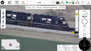
I believe commercial UAV Remote Pilots will be especially interested in the 520E, which is beginning to ship.
The new H520E is the second generation in Yuneec's professional line.

Yuneec has redesigned the drone with a completely new
processor with increased computing power in its existing and proven design,
preparing it for the development of new applications and a number of payloads.
The comments and expectations of H520 users have been met by making improvements that
we were hoping for.

LONG RANGE, STABLE CONNECTION
One of the most substantial improvements that will be welcomed by all users is
the range - it has been more than doubled by using OFDM signal modulation
technology. The result of using this solution in the new H520E is an extension of
transmission range up to 7 km for American models (3.5 km for European models)
and increase of connection stability in locations with high amount of radio
interference (e.g. in cities). Yuneec has also used a different kind of antenna,
and relocated to the bottom of the arm endings. The black OFDM module can be
seen under the hull.

H520E RTK - MORE THAN ACCURATE
H520E will also appear in a variant with RTK support. This system allows you to
make photogrammetric surveys of exceptional precision, in the range of 1-1.5cm.
It will be willingly used by surveyors and other users who create professional,
accurate orthophotomaps, 3D models or other surveying or construction
documentation. Moreover, the use of RTK allows to improve the drone's stability
in places where errors in reading the position from GPS can occur due to
reflected signals (so called multi-path error), e.g. next to tall buildings or in
canyons. Yuneec does not forget about existing users and at the same time
introduces the long-awaited RTK upgrade to previous H520 models.

A PORT FOR CAMERAS AND SENSORS TO MEET FUTURE NEEDS
Looking at the new H520E, an attentive observer will also see that payload is
mounted in a new way. First of all, the old gimbal plates have been replaced by a
wider, openwork construction containing 6 (compared to the previous four) oil
dampeners. Secondly, this structure is permanently attached to the drone and the
cameras are replaced by an advanced mounting system based on a rotating locking
ring. This has allowed the use of a new payload connector with 30 pins instead of
the previous six. This gives greater expandability, and opens up a lot of room
for the suppliers of unusual devices and sensors, who, using the SDK and the new
connector, will be able to retrofit the H520E with more payloads, extending the
drone's functionality almost infinitely.

H520E PROCESSOR POWER
In order to cope with the additional tasks and loads that may be involved, the
drone's main processors and equipment have been replaced by new units with
significantly increased computing power. The controller in the new edition
received a modern quad-core processor.

CHANGE OF POWER SYSTEM
The drone's power system has also been refreshed. First of all, the battery
capacity has been increased to 6200mAh, so the maximum flight time has been
extended to 25-30 minutes. Yuneec also used a new battery connector already known
from Yuneec H3, which increases the level of safety and maintains better
parameters at high load. In addition, the drone is equipped with a sensor for
correct battery installation, so the user will receive a warning, and the drone
will not start if the battery is not installed correctly.

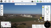
The DataPilot application has been adapted to handle novel functionalities -
several new items have appeared in the menu, including GNSS-RTK, where the user
can set up Network RTK communication or communication with his own base station,
and special sub-menus for handling unusual payloads, such as a load drop system.
The proven design and layout of the DataPilot function has been maintained
roughly unchanged, while maintaining its rich functionality - especially in terms
of precise planning of various types of autonomous flights.

H520E
YCAP - A WORLD OF NEW DEVICES WORKING FOR H520E
Yuneec has established the official YCAP (Yuneec Certified Accessory Program) for
external devices for H520E, so that manufacturers of accessories and payloads for
H520E can certify their products. This will ensure full compatibility,
integration and safety of these accessories. At the same time the manufacturers
are provided by Yuneec with tools and support in developing the best possible
solutions. So we can expect the emergence of devices such as tethered power
systems, multi-spectral and gas sensors, payload release systems and much more.

NEW GENERATION
The new generation H520E builds on the best features of the older version - a
stable six-rotor design, very advanced autonomous flight planning software, a
proven PX4 flight controller and a practical ST16S controller. However, the
individual components have been improved and adapted to the requirements of the
drones of the future. With its extended range, RTK options, extended flight time
and other improvements, as well as the infinite possibilities for external
payloads, the H520E is ideal for almost any professional application.

As many forum members remember, U.S. pilots and technicians based in Las Vegas
were largely responsible for the original H520 final product.
there is a manual for the h520e rtk, I ordered it and it has to get to me but I would like to study it first, thank you
 
Couple early quick tests of the E30ZX. Pic clips from beginning and ending of videos. Actual, no editing, lol. In both cases distance about 600'. Height A 100', height B 30'.
A: Vehicle ID
E30ZX_VID-far-b.jpg
E30ZX_VID-zoom-b.jpg

B: Pic Recovery-turned out not to be the missing Rembrandt
E30ZX-picsearchfar-b.jpg
E30ZX-picsearchzoom-b.jpg
 
just did 2 flights with the e30zx. wow at 380 to 390 agl. I got better than expected results. flying fom buckeye park liepsic ohio I was able to read csx mile marker clearly location was good bit north of the norfork southern crossing. also was a able to clearly read the reporting marks on some covered hoppers well northern end of the interchange track. Also got some good zoom pics of ns locos at the steel rolling mill. I am going to need a lot of practice to get zoom shots from 380 to 390 agl. pan and tilt of the camera going to take a lot of work to get steady shots. now if yuneec can sync the tilt capability of the camera to zoom in level with the more it's zoomed in the slower and smoother the tilt movements become. same with the pan knob. more it's zoomed in the pan knob responds more smooth and steady.
 
first five photos are where the camera was zoomed in. the last photo is the reference shot where the camera is 1x.
 

Attachments

  • 2014-01-01_00.13.39.860.jpg
    2014-01-01_00.13.39.860.jpg
    103.8 KB · Views: 13
  • Screenshot_2014-01-01-00-16-41.png
    Screenshot_2014-01-01-00-16-41.png
    668.5 KB · Views: 12
  • Screenshot_2014-01-01-00-17-59.png
    Screenshot_2014-01-01-00-17-59.png
    600.2 KB · Views: 11
  • Screenshot_2014-01-01-00-20-34.png
    Screenshot_2014-01-01-00-20-34.png
    823.3 KB · Views: 11
  • Screenshot_2014-01-01-00-21-50.png
    Screenshot_2014-01-01-00-21-50.png
    703.5 KB · Views: 13
  • Screenshot_2014-01-01-00-40-01.png
    Screenshot_2014-01-01-00-40-01.png
    538.6 KB · Views: 14
also at max I was able to see deshler belmore and hamler ohio. I was focusing north. had I focus south towns of ottawa and possible glandorf would be in veiw . cam pointed west miller city would have been in view. I wish I had the cam on hand when I was in missouri. did 4 flights in metamora oh it was real windy but the h520e and e30zx held up solid. maxed out the towns blissfeild was in veiw toledo downtown skyline was in view. sylvania was in view.
 
Just ordered our H520E RTK! We've got all the other GNSS gear required and will be running PPK. I'd love to start a Private Chat with other users specifically for it if anyone is interested...
 
  • Sad
Reactions: Mike Irish
chascoadmin, I take it you need to do precision survey work?
 

New Posts

Members online

Forum statistics

Threads
20,954
Messages
241,586
Members
27,284
Latest member
csandoval