Hello Fellow Yuneec Pilot!
Join our free Yuneec community and remove this annoying banner!
Sign up

H520E RTK From the Box Up

Is anyone else noticing issues with the GPS date in the EXIF data?
This is unfortunately "normal" I was told when changing the ST16's battery without being connected to a WLAN (no network time). The time has to be set manually...
 
This is unfortunately "normal" I was told when changing the ST16's battery without being connected to a WLAN (no network time). The time has to be set manually...
I have checked that the time and zone are correct and I don't think it's ever on when there's not Wi-Fi available but I don't doubt that's the case because it has always been. It was actually the first barrier of using the H520 data in during the flight. They had to alter their code to compensate for it. Apparently it changed again with the E model so we've had to tweak it again.
 
Using the E90X we are 24 flights in now and we have had 3 occasions where the mSD wasn't recognized
I had this too with the H520 E90. I don't know if it still is a problem but generally for me it worked best when having an mSD card inside the e90 that already has its folder structure and a "number-0001"-dummy-image as a "template" alreday in the images folder...
Almost every time I try to format the mSD card on site (only when missioning testwise) something strange happens:
- counting images on the ST16 UI but no images are later on the mSD card (not a single one present).
- not counting images on the ST16 UI but all images are on the mSD card (not a single one missing).
I only use 64GB exFAT cards from sandisk.
 
trying to hit the exact coordinate of the turn waypoint
that is what I suspect, too.
Both are receiving the same corrections via NTRIP but as an example on one of the maps the east checkpoint moved about 1ft further to the east than the west checkpoint did.
Just a question: is the X/Y-error greater the further the H520-Rover-GPS-antenna is away from the base station GPS-antenna. (I thought you were using onboard NTRIP only).
I "learnt" or "heard" that base/rover-data is always handled relatively. So H520 RT positioning and the images' EXIF GPS values are only absolute if you use onboard-NTRIP-RTK-only.
 
I had this too with the H520 E90. I don't know if it still is a problem but generally for me it worked best when having an mSD card inside the e90 that already has its folder structure and a "number-0001"-dummy-image as a "template" alreday in the images folder...
Almost every time I try to format the mSD card on site (only when missioning testwise) something strange happens:
- counting images on the ST16 UI but no images are later on the mSD card (not a single one present).
- not counting images on the ST16 UI but all images are on the mSD card (not a single one missing).
I only use 64GB exFAT cards from sandisk.
Same here. I haven't had it on the H520 for a long time. I also format the card on the drone every time before I fly. I'll have to pay better attention next week to see the consistency and whether or not the formatting changes the behavior.
 
that is what I suspect, too.

Just a question: is the X/Y-error greater the further the H520-Rover-GPS-antenna is away from the base station GPS-antenna. (I thought you were using onboard NTRIP only).
I "learnt" or "heard" that base/rover-data is always handled relatively. So H520 RT positioning and the images' EXIF GPS values are only absolute if you use onboard-NTRIP-RTK-only.
If you are using a base station that communicates directly to the aircraft then yes you will lose thousandths as you move hundreds of feet away from the base. Not just the absolute accuracy but the stability of the RTK fix starts to become an issue. If you have your own base and you cast it then you have the same condition as NTRIP and are only limited to your proximity to the CORS. This is why VRS is such a good option for long roving.

But I am consistently seeing is that the larger the project the more camera location error I am getting. This is primarily because as the photos on the most distant points get further away from each other the processing software has to do more work to tie the entire site together. It stays pretty consistent at a certain point if you're using GCP's but if you don't use GCP's it will continue to float up. I don't think I've done anything large enough to say definitively whether or not it hits a static point.
 
  • Like
Reactions: vr-pilot
It stays pretty consistent at a certain point if you're using GCP's but if you don't use GCP's it will continue to float up. I don't think I've done anything large enough to say definitively whether or not it hits a static point.
Hi,
have you seen this already (?):
It is really a "deep dive" into this topic. Hopefully the H520E-RTK gets all the stuff "aligned" as well. Especially the "Time Sync subject" of acurately syncing the camera position below the flying GNSS antenna (rover) with the actual exposure time of the projected image plane is a challenge...
 
  • Like
Reactions: chascoadmin
Hi,
have you seen this already (?):
It is really a "deep dive" into this topic. Hopefully the H520E-RTK gets all the stuff "aligned" as well. Especially the "Time Sync subject" of acurately syncing the camera position below the flying GNSS antenna (rover) with the actual exposure time of the projected image plane is a challenge...
This was the first question I asked before getting the H520E RTK. I was assured it does use the offset and aircraft attitude data to write the correct geotag values and not just the position of the antenna. This is why they also provide the timestamp file for PPK use. It contains all the relevant attitude data necessary to make those calculations after the fact.
 
  • Like
Reactions: vr-pilot
Be assured that we'll get it figured out. The same thing happened with the P4RTK and it took us 3 months to get a proper workflow figured out. I can promise you that I won't let up until they show the effort. Supposedly they already have a group in Oklahoma that is doing it successfully. That's all I can share for now but I will update later.
Thanksss
 
View attachment 25358

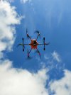
The other threads seemed to be going a slightly different direction so I decided to start this new thread for practical experience on unboxing through troubleshooting, configuration and firmware updates. I will be using the E90X camera.

I finally got everything in from Vertigo and am starting configuration and testing today. First issue I have hit is that I have no control of the E90X. It starts correctly, centers and can even be calibrated, but the RC input is not doing anything. (UPDATED) Maybe it was just the act of a reflash, but going from E90X v1.0.74_A to v.1.0.75_A and we now have RC control of the camera. Interesting thing is that the updates according to the RC report a "newer" v1.0.65_A....

Also, what is the update protocol? The is no longer an UpdatePilot app and the software reports what is current and available but there is no action to take.

Next hiccup is that the ZIP file for the ODFM as on the downloads site seems to be corrupted and unable to be opened.
I am having the same problems. This drone should be able fly further with no problems but I keep getting lost video feeds and control issues. I was hoping the OFDM update would solve some if the problems.
 
how far do you get before video feed loss. and when the feed cuts out what's the icon like on the ofdm on data pilot. no dot, dot, dot with one line above it, dot with 2 lines above it? and for control what is your rssi percent when issues happen? what location are you flying from. just had massive repairs done to h520e and e30zx. hit a tree limb due to low bat rtl trigger at 15percent. Damage to drone not so bad but the camera was a killer lost internal lens the external lens and camera body fully intact. cost for drone alone parts and labor 250. camera repair e30zx internal zoom lens 990.00.
 
how far do you get before video feed loss. and when the feed cuts out what's the icon like on the ofdm on data pilot. no dot, dot, dot with one line above it, dot with 2 lines above it? and for control what is your rssi percent when issues happen? what location are you flying from. just had massive repairs done to h520e and e30zx. hit a tree limb due to low bat rtl trigger at 15percent. Damage to drone not so bad but the camera was a killer lost internal lens the external lens and camera body fully intact. cost for drone alone parts and labor 250. camera repair e30zx internal zoom lens 990.00.
Oh no, that hurts! Did you have a maintenance agreement on it?

I've only lost video once so far as it went behind a building for about 5 sec. OFDM went to no bars, went black screen and had a blue spinning circle in the middle. Once it emerged it came right back on.
 
yuneec was said to make changes again to the antennas coming down from the arms for the h520e due to repair issues they had with the first ones. I will know for sure once I get it back tuesday.
 
  • Like
Reactions: chascoadmin
It is so quiet on this forum so I thought I would provide a small update. We have now flown 50 missions with the RTK and I can say that I am impressed and had a little bit of a change of heart about RTK on a drone. I still maintain that it is risky to solely rely on the RTK data but we have only had 5 of those 50 that required PPK to be performed. The most consistent scenario is that we fly with RTK, PPK after wards to verify the corrections and have been averaging a 3-5% float. Looking at where these float conditions exist will determine the approximate number of photos that were affected and whether or not we need to continue with retagging the images. Obviously it depends on the requirements of the flight but we still use 4-7 GCPs depending on the size/shape of the site so unless the float is right on top of the GCP or it is a grade critical mission I am not worrying about it.
 
  • Like
Reactions: Pawel_(PL)
It is so quiet on this forum so I thought I would provide a small update. We have now flown 50 missions with the RTK and I can say that I am impressed and had a little bit of a change of heart about RTK on a drone. I still maintain that it is risky to solely rely on the RTK data but we have only had 5 of those 50 that required PPK to be performed. The most consistent scenario is that we fly with RTK, PPK after wards to verify the corrections and have been averaging a 3-5% float. Looking at where these float conditions exist will determine the approximate number of photos that were affected and whether or not we need to continue with retagging the images. Obviously it depends on the requirements of the flight but we still use 4-7 GCPs depending on the size/shape of the site so unless the float is right on top of the GCP or it is a grade critical mission I am not worrying about it.
indeed has the forum been quiet. Great you are blowing some new life into it.
Good to hear from someone who has experience and is willing to share
 
  • Love
Reactions: chascoadmin
Somewhere in Poland...
 

Attachments

  • 20201109_170648.jpg
    20201109_170648.jpg
    763.8 KB · Views: 14
  • 20201023_125348.jpg
    20201023_125348.jpg
    1.2 MB · Views: 12
  • Screenshot_20191007_205130_org.mozilla.firefox.jpg
    Screenshot_20191007_205130_org.mozilla.firefox.jpg
    505.6 KB · Views: 11
  • IMG_20180627_094617.jpg
    IMG_20180627_094617.jpg
    6.3 MB · Views: 13
  • IMG_20180626_085807.jpg
    IMG_20180626_085807.jpg
    4 MB · Views: 15
Somewhere in Poland...
I would swear that picture with the car in it is northeast Texas or Arkansas. Love the toggle tag on the battery. I flip mine over in the case, top up looking down is charged and top down is discharged/stored but every once in a while I forget what I'm doing and then it's just a guessing game or wasting RC battery to find out. Sure would be nice to have some LED indicators...
 
  • Like
Reactions: Pawel_(PL)
I would swear that picture with the car in it is northeast Texas or Arkansas. Love the toggle tag on the battery. I flip mine over in the case, top up looking down is charged and top down is discharged/stored but every once in a while I forget what I'm doing and then it's just a guessing game or wasting RC battery to find out. Sure would be nice to have some LED indicators...
Yeh, there are places around the world looking very much alike. Come to Poland then and you will not miss Texas.
The tags work well for me. I also keep a record of each how many charging cicles each battery has gone through so that I can somehow keep them on rotation.
The LEDs - would be indeed nice to have them... But since we don't have them we have to find ways around.
 

Attachments

  • 20210905_085438.jpg
    20210905_085438.jpg
    1.9 MB · Views: 8

New Posts

Members online

No members online now.

Forum statistics

Threads
20,954
Messages
241,586
Members
27,284
Latest member
csandoval