Hello Fellow Yuneec Pilot!
Join our free Yuneec community and remove this annoying banner!
Sign up

new firmware solves it - Wrong altitude on Exif Information of my H520E and E90X (with work around by h-elsner!)

I faced this problem too and decide for me to use from the pictures only GPS coordinates. All the rest I'm using from the timestamp of the log. For me is important to know not only altitude but the true north and yaw of the copter from it and camera tilt and pan position. The last is a little tricky. I don't plan to share this knowledge for now, because it is tied with the channel settings, which are difficult to explain.
You will never know the pan angle of the camera except if it points foreward (CH10 pan mode = 683).
 
If you load the .tlog file in Q500log2kml you can convert that file to CSV. There are not all data values in, but only those I have found intresting. But I can add more if you want. Go to Settings (Einstellungen) > Data analysis (Datenanalyse) and set Sensor data PX4 as CSV file (Sensordaten PX4 als CSV Datei) to true (right part of the screen).
The output format is described in Manual / Appendix as self-defined CSV format.
If you feel that there are too much information you can exclude not needed MAV link messages. The relationship of data values to MAV link messages is also described in this table with self-defined CSV format

Gruß HE
Thanks a lot!

The "PS4 as CSV" was exactly the reason why no CSV file was ever produced. Thanks for this!
Your software is great!
German: Kleiner Verbesserungsvorschlag von mir, damit das Programm richtig angezeigt wird muss ich in den Kompatibilitätseinstellungen unter Hohe DPI auf Skalierung durch System umstellen. Außerdem kann es sein dass die H520E eine andere Dateistruktur hat?
Q500log2kml Setting.png Ein Screenshot von "vorher": Q500log2kml Scrsh.png


I have attached the original pictures (I compressed it without changing the EXIF data because it would be too much MB) as well as the flight logs, I will remove them again sometime.

I took pictures with both drones, H520E and Mavic Mini, at 3 "locations" in 3 different heights and compared the Exif heights here:
EXIF Infos Yuneec VS DJI.png Location A / B / C - Height - Y (Yuneec H520E) / D (DJI Mavic Mini)


I have also manually adjusted the GPS coordinates, more precisely the altitude, in the exif information, by moving the decimal point. And then I aligned the pictures, the result was more satisfying.
But the manual adjustment is no solution, do you have any suggestions here?

RC Changed heigt.png


Since the heights in the logs are correct and since the software Reality Capture can handle it, as soon as I move the comma in the Exif data one position to the right, it seems that the camera saves the height in the EXIF incorrectly.

If I see this wrong, please correct it!
The question remains now, how do I "fix" it.


PS:

UAV Toolbox should allow you to replay the flight and check the altitude at the point of each photo so you can compare the reported altitude against the log altitude. If you're only experiencing this for some images, it may be that you had a poor GPS fix, but you'll need to go through a number of image sets to see if there's any consistency in the error.

I've not found an easy tool for correcting/injecting EXIF information I'm afraid, but given the H520 usually has consistent log data, it should be possible to provide the correct altitudes for each image.
"EXIF Pilot" let you change the Koordinates Editing, Creating and Viewing EXIF data with free Exif editor

NOTE:
I also noticed that I seem to have installed newer versions than the currently available ones ... except for the OFDM link.
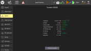
Also the UpdatePilot and Check for Update in the controller says that "newer" updates are available, although they have a "lower" number. Maybe it has something to do with this.
Screenshot_2020-11-13-12-06-49.pngScreenshot_2020-11-13-12-07-29.png

Update: Logs and Pictures removed due to privacy.
 
Last edited:
Außerdem kann es sein dass die H520E eine andere Dateistruktur hat?
Reading from the Yuneec site I have an opinion that logfile will no more available for the consumer of the product.

QUOTED:

Protection Of Sensitive Data​

The H520E has been developed as a closed system, its technical design prevents communication with third-party servers. Communication only takes place between the drone, the payload, and the ST16E remote control. Log files are stored locally in the drone and are only required by Yuneec for service purposes in the event of a guarantee. There is no involuntary data transfer to servers. Neither flight data nor images, videos, or log files are forwarded to external servers and remain in your possession. Thus, your data is optimally protected.

--- END of the quotation.

Few days before in the same place on the official Yuneec site were some words like China and Germany, but the brain goes over the emotion.
I can access, download and save all log files.

Direct from the drone itself: Ulog
And from the remote: tlog /utm / Sky

And I can also open and read these files, but it doesn't look completely right everywhere, so I think that these files are maybe structured differently. But I definitely can do it.

I rather think that it says that they don't transfer these files anywhere unless I do it myself.
 
  • Like
Reactions: Tuna and Mike Irish
You can upload your ulog files from the aircraft at Flight Review and get a link to share info when you desire.
 
  • Like
Reactions: Hypano
You can upload your ulog files from the aircraft at Flight Review and get a link to share info when you desire.
All right, I will do that case needed. For now I have uploaded all data here: Wrong altitude on Exif Information of my H520E and E90X (Update: Logs and Pictures removed due to privacy.)

I have now contacted Yuneec's support directly, that it seems to be a software problem on their side.


I have added the current information in the initial mail / question
 
Last edited:
  • Like
Reactions: Mike Irish
Die DJI fliegt aber tief. Der Ort liegt laut Wikipedia bei 442m, aber in den EXIF Daten D10 steht 390m.

2020-11-13 10-08-44.tlog no flight, ignored.
To check 2020-11-13 10-29-07.tlog.

There are different data for altitude. I need to check that:
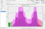
ScreenshotHöhenprofil_1.png
Summary is:
Höhe bei Null: 437.5m
Absolute Gipfelhöhe: 503.6m
Relative Gipfelhöhe: 66.1m
 
  • Like
Reactions: Hypano
waiting on the dual charger for the h3 that has been just ordered from yuneec usa to see if I get the same type of issue with my new h520e that just came in.
 
  • Like
Reactions: Mike Irish
waiting on the dual charger for the h3 that has been just ordered from yuneec usa to see if I get the same type of issue with my new h520e that just came in.

Foundit and have the link!​

Here is the link for the H520e and the double battery charger. There the new type concoctions.
yuneec.pl

DY5 - DUAL CHARGER FOR Yuneec Typhoon H3, H520E

DY5 - DUAL CHARGER FOR Yuneec Typhoon H3, H520E | | SHOP \ ACCESSORIES \ Inne SHOP \ DRONES \ Typhoon H3 \ Akcesoria SHOP \ DRONES \ Yuneec H520E \ Akcesoria | Sklep Yuneec.pl
yuneec.pl
yuneec.pl
Regards.
Mike
 
  • Like
Reactions: Hypano
from yuneec Germany. Hello Mr. Davidson, Many thanks for using our products and the positive feedback about the charger you are already using for your H520. Indeed, a charger for the Typhoon H 3 batteries is already available. In Europe it is available with the article number YUNDY5-2EU This charger cannot be used to charge the H520E batteries but for the H520E batteries a multi charger should also be available after the product's launch in November.
 
from yuneec Germany. Hello Mr. Davidson, Many thanks for using our products and the positive feedback about the charger you are already using for your H520. Indeed, a charger for the Typhoon H 3 batteries is already available. In Europe it is available with the article number YUNDY5-2EU This charger cannot be used to charge the H520E batteries but for the H520E batteries a multi charger should also be available after the product's launch in November.
This information that you got from Yuneec Germany seems to contradict what I got from the Youneec sight in Poland? This clearly shows the battery connections are the same and the charger is advertised for the H3 and the H520e. Someone is wrong or just maybe it isn't available yet in Germany?
DY5 - DUAL CHARGER FOR Yuneec Typhoon H3, (H520E)
Regards.
Mike
 
  • Like
Reactions: Hypano
Die DJI fliegt aber tief. Der Ort liegt laut Wikipedia bei 442m, aber in den EXIF Daten D10 steht 390m.

2020-11-13 10-08-44.tlog no flight, ignored.
To check 2020-11-13 10-29-07.tlog.

There are different data for altitude. I need to check that:
View attachment 23850
Summary is:
Höhe bei Null: 437.5m
Absolute Gipfelhöhe: 503.6m
Relative Gipfelhöhe: 66.1m
Die DJI scheint jedesmal den Sensor irgendwie zu kalibieren da geht die Höhen angabe ungefähr auf gleicher Höhe aber an verschiedenen Tagen von 390 bis zu 630Meter über Null (hab dir hier mal ein paar Bilder ins Zip, falls es dich interessiert)
Ich stelle dir gerne weitere Daten zu Verfügung, wenn du weitere benötigst. Geb einfach Bescheid welche

------
I also have pictures of a H520 "without E", from about the same position,( height above ground but I think 35 meters or even more) there the height above sea level is written correctly as 460 meters in the EXIF data.
I have attached a picture of it (I will remove this one in a few days too).


This information that you got from Yuneec Germany seems to contradict what I got from the Youneec sight in Poland? This clearly shows the battery connections are the same and the charger is advertised for the H3 and the H520e. Someone is wrong or just maybe it isn't available yet in Germany?
DY5 - DUAL CHARGER FOR Yuneec Typhoon H3, (H520E)
Regards.
Mike
I received my H520E on the 24.10.20, the dealer told me the dual charger is also ordered and he will notify me as soon as it is available. This was not the case yet.
So I think you may be right that it is not yet available in Germany.


Update: Pictures removed due to privacy.
 
Last edited:
  • Like
Reactions: Mike Irish
Die DJI scheint jedesmal den Sensor irgendwie zu kalibieren da geht die Höhen angabe ungefähr auf gleicher Höhe aber an verschiedenen Tagen von 390 bis zu 630Meter über Null (hab dir hier mal ein paar Bilder ins Zip, falls es dich interessiert)
Ich stelle dir gerne weitere Daten zu Verfügung, wenn du weitere benötigst. Geb einfach Bescheid welche

------
I also have pictures of a H520 "without E", from about the same position,( height above ground but I think 35 meters or even more) there the height above sea level is written correctly as 460 meters in the EXIF data.
I have attached a picture of it (I will remove this one in a few days too).


I received my H520E on the 19.9.20, the dealer told me the dual charger is also ordered and he will notify me as soon as it is available. This was not the case yet.
So I think you may be right that it is not yet available in Germany.
Yes I checked Yuneec's site in Germany and it's showing out of stock expected shortly. I am also querious what are the Mah shown on your batteries.
BATTERY4S 5250mAh 15,2V LiPo
BATTERY4S 6200mAh Li Ion
 
  • Like
Reactions: Hypano
Yes I checked Yuneec's site in Germany and it's showing out of stock expected shortly. I am also querious what are the Mah shown on your batteries.
BATTERY4S 5250mAh 15,2V LiPo
BATTERY4S 6200mAh Li Ion
If you want I can take a picture of the battery on monday.

The bill definitely say:
YUNH520EB4SA62k0k0u für H520e LiIo4s6200

Charger even if not yet received:
YUNDY52EU Yuneec DY5 Dual Ladegerät H520E
 
  • Like
Reactions: Mike Irish
the battery voltage is h3 15.2v h520e 15.4v . first gen h520 and h3 are the same type which has the label lithium polymer on it the h520e is labeled lithium ion.
 
let's keep this thread on target it's getting a bit off.
Sorry men. Just trying to help out a fellow member, I don't want to see him stuck with the wrong batteries or charger.
Regards.
Mike
 
As already stated above, the decimal delimiter is wrong in the EXIF data from E90X when I look into the EXIF raw data. It needs a FW update, imho.

What it come from, I do not know at the moment. I need to check all possible Altitudes in the TLOG file. Theoretical there are:
From MAVlink message GPS_RAW_INT:
alt [mm] Altitude (MSL). Positive for up. Note that virtually all GPS modules provide the MSL altitude in addition to the WGS84 altitude.

From MAVlink Message GLOBAL_POSITION_INT
alt [mm] Altitude (MSL). Note that virtually all GPS modules provide both WGS84 and MSL.

From MAVlink message ALTITUDE:
altitude_monotonic [m] This altitude measure is initialized on system boot and monotonic (it is never reset, but represents the local altitude change). The only guarantee on this field is that it will never be reset and is consistent within a flight. The recommended value for this field is the uncorrected barometric altitude at boot time. This altitude will also drift and vary between flights.
altitude_amsl [m] This altitude measure is strictly above mean sea level and might be non-monotonic (it might reset on events like GPS lock or when a new QNH value is set). It should be the altitude to which global altitude waypoints are compared to. Note that it is *not* the GPS altitude, however, most GPS modules already output MSL by default and not the WGS84 altitude.
altitude_local [m] This is the local altitude in the local coordinate frame. It is not the altitude above home, but in reference to the coordinate origin (0, 0, 0). It is up-positive.
altitude_relative [m] This is the altitude above the home position. It resets on each change of the current home position
altitude_terrain [m] This is the altitude above terrain. It might be fed by a terrain database or an altimeter. Values smaller than -1000 should be interpreted as unknown
bottom_clearance [m] This is not the altitude, but the clear space below the system according to the fused clearance estimate. It generally should max out at the maximum range of e.g. the laser altimeter. It is generally a moving target. A negative value indicates no measurement available.

That's a lot of data. Have to check what is used and what is in. Need to think about how I can make it visible. Please be patient, this may take some time. Also I have to bring this together with the EXIF data from the pictures (some kind of geotagging).

br HE
Maybe an update will change something there, so I don't know if it is advisable that you invest a lot of time already.
But as I said before I don't have any knowledge in these areas.

If you need other data/ pictures just let me know.
 

Members online

Forum statistics

Threads
20,973
Messages
241,794
Members
27,357
Latest member
Bech