Hello Fellow Yuneec Pilot!
Join our free Yuneec community and remove this annoying banner!
Sign up

ST16 remote GPS stability issue.

Joined
Sep 28, 2020
Messages
1,287
Reaction score
507
Age
55
Location
Kozloduy, Bulgaria
I have some doubts about the stability of the GPS receiver installed inside the ST16. Accuracy is relatively low. The height measurement is very poor.

Can someone check in their own logs, are there the same, or I should do some troubleshooting with this controller?

Probably I'll try to place a GPS receiver somewhere away from me and the controller, and I'll use a radio-link for UART communication, but this is not clear in my head for now.

Accuracy.jpgAltitude.jpg
 
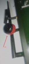
With the antenna outside of the ST16 body, the results are very promising.

View attachment 24928
How have you found the GPS signal since you repositioned it. Did you modify the standard omni directional antenna and if so how?
Cheers.
Mike
 
Here is cold, so I have not flighted after the modification. From my balcony, I got 7-10 satellites. Before the modification 2-3, no more.

The major problem was when I use the ST16 in a regular way. The antenna was covered from my body most of the time. For some reason for me is important to have good reception in the remote. Still, I have no control over what I'm receiving, so, the first step is to organize a better receiver setup.
 
Did you modify the standard omni directional antenna and if so how?
Please clarify what antenna we are talking about. If the GPS antenna, no, this is the same, which is inside the ST16. Especially this one is from another ST, but this doesn't matter. I preferred to save in place one antenna and to add additional wire to another.


-----

Probably understood what you're asking. This ST16 was with two antenna connectors. This is not a plus one. But yes, you can add one 2.4 GHz internal antenna and use the wiring from another to attach them to the GPS receiving port. The more difficult step is to put the GPS antenna in the body of the WiFi antenna. There some skills are should be presented.
 
Last edited:
Good idea leaving the original in place and disconnecting it, then adding the external antenna.

How much improvement have you noticed in satellite acquisition?
 
7 - 8 satellites in the first 30 seconds.
 
Last edited:
More to say.
1. 7 satellites in the first few seconds on the open sky;
2. 35 seconds to turn on the solid purple;
3. Up to 11 satellites after less than a minute;
4. White blink on the copter (FollowMe acceptable) in less than 15-20 seconds after solid purple;

IMHO a "must do it" modification.
 
The next question that arises now is what datum is used in this receiver? Looks like an almost precisely undulated WGS84.

Online geoid calculator

Please, who wants and can, check your log files. As I discovered, somewhere datum is pure WGS84, somewhere is corrected one. For pure WGS84 coordinates and height, anybody can use data from the Internet or some phone application. I'm using Mapit GIS (pro is welcome).
 
Can someone test this application on the ST16?


File in the attachment.
 

Attachments

  • GPS NMEA tool.apk.zip
    354.5 KB · Views: 4
No access to GPS through Android system, so the app doesn’t work.
 
  • Like
Reactions: Vaklin

New Posts

Members online

No members online now.

Forum statistics

Threads
20,952
Messages
241,577
Members
27,284
Latest member
csandoval