

You are using an out of date browser. It may not display this or other websites correctly.
You should upgrade or use an alternative browser.
You should upgrade or use an alternative browser.
How high can you go?
- Thread starter Rayray
- Start date
-
- Tags
- maximum height
I don't think I have ever flown my Q500 4K up to 400 feet high, if I did, I probably could not see it, I fly just over the tops of my big Maple trees, or no more than around 200 feet high, if I want a picture higher than that, I just go to Google Earth and get a satellite view ........really no reason to fly with the airplanes.....that wide angle camera would make everything on the ground, to small anyways , and the altitude reading close to the ground is not accurate it may read 10 or 12 feet high, yet I can reach out an touch it with my hand..and I know I am not 12 feet tall..........OK, I guess I was not clear with my question. About half gave answers I wanted, many started off on laws and regulations.
First, I should have said in the USA. Typhoon H's sold here have a ceiling of 400' in the firmware. All I wanted was to check the accuracy of the Altimeter (barometer). In other words, if you live here, buy a Typhoon H and do not alter it or change the firmware limit, how high does it say it goes?
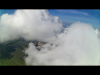
I know even if it says 400' it may not be. I flew 2 batteries just now in the twilight, and this screen shot was about the same for both. Using Brer Rabbit it shot to 410' but immediately dropped lower. Just having fun, wasting time.
View attachment 3833
- Joined
- Jan 28, 2017
- Messages
- 518
- Reaction score
- 161
- Age
- 71
The other day I took my "H" up to the 400' limit and brought it back down and hovered at approximately 30' and the ST-16 was still indicating 125'. Is the altimeter just an air pressure sensor or is it an approximation derived from the GPS signals. In any case sadly it is not accurate
It would seem to me that if you wish to know what the ceiling altitude Typhoon H is capable of flying you simply need to head for the hills.The geofence is set to 400'/122 m above the transmitter e.g. AGL. If you stand atop a 1000' hill and are able to fly to 400' then you can safely assume the Typhoon H can reach at least 1400'. Go a bit higher and try again until your drone starts having trouble climbing. At that point you will know how high the Typhoon H can fly. I imagine the drone would simply become ever more sluggish and at some point start having trouble correcting it's position as you increase you altitude. This would be a good point to stop before you break something.
Though at each location you would be in compliance with the law as you would be below 400' AGL, flying off to the side of a peak over an abyss might put you in a questionable situation depending on how you interpret AGL depending on whether of not it is considered the distance below the aircraft or the height above the person flying it.
It would be an interesting experiment to be able to find out what the maximum ceiling is and fun finding out.
I assume it is GPS determined.The other day I took my "H" up to the 400' limit and brought it back down and hovered at approximately 30' and the ST-16 was still indicating 125'. Is the altimeter just an air pressure sensor or is it an approximation derived from the GPS signals. In any case sadly it is not accurate
I've seen various numbers on my H and it all depends on how I'm flying. I've never intend to go over 400' for recreational purposes, but I like to go up to 400' to get great shots of the Atlanta Skyline. The H will will do it's best to stop at the programed limit, but it will depend on the speed and weather conditions. Most likely if you climbing at max speed, momentum will take a well past the limit as opposed to someone who slowly approaches the limit. Keep in mind that laws vary nation to nation, I know 400' is the limit AGL (over ground) and any man made structure being inspected, but I can't speak for anything outside of the US. I am FAA CFR Part 107 certified.
I put a few of my videos below, tell me what you all think of them. Are they boring or should i make more?
I put a few of my videos below, tell me what you all think of them. Are they boring or should i make more?

PatR
Premium Pilot
- Joined
- Jan 28, 2017
- Messages
- 518
- Reaction score
- 161
- Age
- 71
I've seen various numbers on my H and it all depends on how I'm flying. I've never intend to go over 400' for recreational purposes, but I like to go up to 400' to get great shots of the Atlanta Skyline. The H will will do it's best to stop at the programed limit, but it will depend on the speed and weather conditions. Most likely if you climbing at max speed, momentum will take a well past the limit as opposed to someone who slowly approaches the limit. Keep in mind that laws vary nation to nation, I know 400' is the limit AGL (over ground) and any man made structure being inspected, but I can't speak for anything outside of the US. I am FAA CFR Part 107 certified.
I put a few of my videos below, tell me what you all think of them. Are they boring or should i make more?
Consider it as this: Photography and Videography is an art form. If it pleases you be prolific. If not find the way it does.
- Joined
- Feb 6, 2017
- Messages
- 27
- Reaction score
- 4
- Age
- 48
This time Mine says exactly 400.. but I'm the past it has been 409, so I'm quickly to bring her back down ..
- Joined
- Jun 18, 2016
- Messages
- 42
- Reaction score
- 20
- Age
- 59
I highest I've flown was 425' ft for one second to make sure the GUI was working and NFZ was installed. Not long ago you could only fly higher than 400' if the NFZ was installed.
")
FlushVision
Premium Pilot
U.K. based here....<snip>...
Though at each location you would be in compliance with the law as you would be below 400' AGL, flying off to the side of a peak over an abyss might put you in a questionable situation depending on how you interpret AGL depending on whether of not it is considered the distance below the aircraft or the height above the person flying it.
It would be an interesting experiment to be able to find out what the maximum ceiling is and fun finding out.
In the U.K. AGL is interpreted as the ground the pilot is actually standing on. If that happens to be close to a 200ft cliff and the pilot sends his unit beyond the cliff edge at, say 350ft height AGL then once he has sent the unit over the cliff he would be flying it at 550ft above the ground that the aircraft is currently over. But he is not breaking the (commercial use) law because the aircraft is still at 350ft AGL...that is, 350ft above the ground that the pilot is standing on.
Important to note that this is the U.K. law and how the CAA looks at it. In other countries it could be different. Best to check your own country's laws and how they are interpreted.
Been @ 350 mtrs (1000 ft) at ease.
Other guy here been @1000 mtrs (3000 ft) no problem, standard equipment, no loss of video or control.
Other guy here been @1000 mtrs (3000 ft) no problem, standard equipment, no loss of video or control.
PatR
Premium Pilot
Prior to obtaining a 107 and flying for fun in a safe location I had one up to 550'. Since obtaining the 107 I have not flown much above 300' to avoid possible definition conflicts between hobby and commercial application. There has also been no need to go higher.
Thanks to Marc Garneau, Minister of Transport and his chicken Little moment, in Canada we can now only fly up to 90 M (296 ft). if you fly above that, people are encouraged by him to call 911 and report you. 911? like they don't have more important things to deal with. We are fighting this to get back to 120 M (~400 Ft).
Thanks to Marc Garneau, Minister of Transport and his chicken Little moment, in Canada we can now only fly up to 90 M (296 ft). if you fly above that, people are encouraged by him to call 911 and report you. 911? like they don't have more important things to deal with. We are fighting this to get back to 120 M (~400 Ft).
Yeh..... great.

In Belgium it is even worse... max alt there is 10 mtrs.

In Netherlands it is 120 mtrs for recreational droning (pofessionals lower...!). I had a special clearence for my 350 mtrs @ friendly glider airpott. That is why I did not go any higher, although I could easily.
FlushVision
Premium Pilot
When I see the tight restrictions imposed on drone users in some other countries it makes me shudder. U.K its 400ft for commercial and the guideline is 400ft for hobby. So, when you look at Belgium, say, then I suppose us Brits can count ourselves lucky. However, I gotta point out that the U.K. law could/will change in the middle term. We'll still get 400ft, but registration is on the cards as well as mandatory insurance for hobby fliers.Yeh..... great.
In Belgium it is even worse... max alt there is 10 mtrs.
In Netherlands it is 120 mtrs for recreational droning (pofessionals lower...!). I had a special clearence for my 350 mtrs @ friendly glider airpott. That is why I did not go any higher, although I could easily.
For my own personal tastes 400ft is ample, and I think I wouldn't scream blue murder if it was 300ft since, certainly, all my best aerial photographs were taken at lower levels than that.
If I lived in Belgium, though, I wouldn't be a happy bunny. No, not at all.
- Joined
- Dec 19, 2016
- Messages
- 60
- Reaction score
- 33
- Age
- 59
Is the altimeter just an air pressure sensor or is it an approximation derived from the GPS signals. In any case sadly it is not accurate
I assume it is GPS determined.
The height readout comes from an on-board Barometer - not the GPS. The Barometer on the H is, at best, a height approximation, as it is dependent on things like temp, air/wind, and I also believe, light. The light shouldn't be as much of an issue as the Barometer is inside the H body.
Similar threads
- Replies
- 9
- Views
- 2K
- Replies
- 9
- Views
- 2K
- Replies
- 16
- Views
- 3K