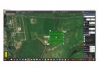
Hello, I was doing my first ever survey and I wanted to use the vehicle follows terrain. I downloaded the correct maps with altitude and set the vehicle to follow the terrain and fly 15 meters above the ground. The checkpoints had the correct altitude but the drone was not following the terrain. It was flying at the same altitude it was set on where the mission started.
You are using an out of date browser. It may not display this or other websites correctly.
You should upgrade or use an alternative browser.
You should upgrade or use an alternative browser.
Vehicle follows terrain doesn't work
- Thread starter stepupmk
- Start date
Thank you @DoomMeister.
Hope to help. Don't have much experience though. I will post my thoughts but need to refresh how I did it first. I will look at the DataPilot, play a bit and then share.
Noticed a subtle difference in wording that can be read with different meanings. Although maps may contain altitude (elevation/terrain?) data, the actual Terrain Data has to be loaded separately as a second file (the "Fetch Elevation Data" box). Is that what you meant?I downloaded the correct maps with altitude
I have refreshed the thing myself a bit and hope I will be able to help. If not too late, sorry for delay.
So as @WTFDproject pointed out you need to "Fetch Elevation Data" for the terrain you want to fly. It is a must should you like to plan and execute Terrain Follow (TF) mission as this is where terrain data is contained.
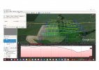
Now, TF mission planning is not much different compared to creating "normal" missions. Major difference is that "Vehicle follows terrain" must be ticked in. One more thing to remember of is to, in my experience, decide on how precisely h520 is to copy terrain. The bigger the "Tolerance" value the less exact the flight is. I always tend to insert 0 as it allows the drone to really copy the elevation changes. Please see Tolerance 0 m (yellow lines) compared to Tolerance 10 m (blue lines) in Google Earth.
  Hope you can see that T10 flight lines are flattened.
Other thing to remember is to adjust Max Climb and Descent rates to vehicle's speed so that it maintains ascent and descent between consecutive waypoints.
You may also like to watch this tutorial:
Hope to help.
Have fun flying.
Should you like to to share how it went we would all like to learn.
So as @WTFDproject pointed out you need to "Fetch Elevation Data" for the terrain you want to fly. It is a must should you like to plan and execute Terrain Follow (TF) mission as this is where terrain data is contained.
Now, TF mission planning is not much different compared to creating "normal" missions. Major difference is that "Vehicle follows terrain" must be ticked in. One more thing to remember of is to, in my experience, decide on how precisely h520 is to copy terrain. The bigger the "Tolerance"
 value the less exact the flight is. I always tend to insert 0 as it allows the drone to really copy the elevation changes. Please see Tolerance 0 m (yellow lines) compared to Tolerance 10 m (blue lines) in Google Earth.
  Hope you can see that T10 flight lines are flattened.
Other thing to remember is to adjust Max Climb and Descent rates to vehicle's speed so that it maintains ascent and descent between consecutive waypoints.
You may also like to watch this tutorial:
Hope to help.
Have fun flying.
Should you like to to share how it went we would all like to learn.
Yes! Would love to hear the real experiences. It is always a good thing to have a first-person account of the actual process. It can help others to be way ahead as they seek to learn the same things.Should you like to to share how it went we would all like to learn.
Similar threads
- Replies
- 10
- Views
- 2K
- Replies
- 1
- Views
- 1K
- Replies
- 54
- Views
- 10K
- Replies
- 7
- Views
- 3K


