Hello Fellow Yuneec Pilot!
Join our free Yuneec community and remove this annoying banner!
Sign up

Guide to Analyzing Breeze Cam FlightLogs - Your Data is Needed

Evrything from your reading was right including the flight time just 51 seconds.

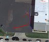
Im using an iphone 6 plus controlling the breeze, upon take off that day from the table when it reach the set height Let it hoover for a few seconds then I tried to control it to go higher and it just fly away by itself and cannot control it on my phone and just drown into the lake. ☹️ It didn’t go higher just went backwards and down to the water.

Base on your reading I hope yuneec will repair it at no cost on my side as it look like an error on the system not the pilot.

Thanks alot!
 
Last edited:
This thread prompted me to pull the first flight log from my breeze. It doesn't show any any inconsistencies or breaks even though I was using a cheap droid pad as the only controller in "follow me" me mode. I wonder if the problem is using the separate bluetooth controller and the pad being unable to "walk and chew gum" at the same time while relaying the commands to the drone in flight... When I looked at it in detail, I could see the period when I was flipping rolling, and spinning the drone to calibrate the compass, when the motors spun up, and when it lost GPS lock as I carried it back into the garage after landing it... can't wait to get home tonight and try downloading the video and putting it into dashware... assuming as you imply that the Q500 and Breeze log converter are compatible.
 

Attachments

  • 1529971236818.log.txt
    101.9 KB · Views: 6
This thread prompted me to pull the first flight log from my breeze. It doesn't show any any inconsistencies or breaks even though I was using a cheap droid pad as the only controller in "follow me" me mode. I wonder if the problem is using the separate bluetooth controller and the pad being unable to "walk and chew gum" at the same time while relaying the commands to the drone in flight... When I looked at it in detail, I could see the period when I was flipping rolling, and spinning the drone to calibrate the compass, when the motors spun up, and when it lost GPS lock as I carried it back into the garage after landing it... can't wait to get home tonight and try downloading the video and putting it into dashware... assuming as you imply that the Q500 and Breeze log converter are compatible.

Keep an eye on it and see if you keep getting good flight logs every time you fly. It will be interesting to find out. The Q500log2kml is a great program and the KML files can be opened with Google Earth Pro or imported into Google Earth online.
 
The KML files are easy; I did that as soon as I had the log by copying everything below the header into excel, doing a text to delimited data using comma as the delimiter, creating a column of texts of the lat and long divided by 10^7, and then copy pasting that into the <coordinates> </coordinates> section of a KML template (strip the txt to see the result in google earth). It's being able to sync the GPS with the video that I'm going to need.... And hoping someone can come up with a way to let me go more than 100 yards from launch point in Follow Me mode.
 

Attachments

  • Flight Log.kml.txt
    25.3 KB · Views: 5
John, I think you just earned yourself a job!

John,

I agree with TStover, have you tried going more than 100 yds in follow me mode to see if you hit geofence? You are hired for the experiment.
 
John,

I agree with TStover, have you tried going more than 100 yds in follow me mode to see if you hit geofence? You are hired for the experiment.

When I got home yesterday, I determined that either the GEOFence is tied to the controller rather than the takeoff point or is ignored for "Follow Me" mode. Also tried out the 1700 mAH GIFI battery... Got the drone 190 yards from takeoff point in about 7 minutes flight time fighting an 8 mph wind which limited the speed the drone could travel, then started walking it back at the first low battery warning and had to catch it in the field 2 minutes later when it went into autoland over some tall grass. When I checked the log with Q500Log2KML, I found that it had dropped 7 individual data points scattered throughout the 9 minutes of flight. The controller I am using is a one year old Digiland DL718M. Unfortunately, I must have been a little careless and didn't notice that I shut down the video recording when I activated the Follow Me slider in the upper left corner, which meant the only video I got was the takeoff, so I haven't tested the Dashware step yet.
 

Attachments

  • Breeze6-28Path.kml.txt
    13.4 KB · Views: 3
  • Like
Reactions: DoomMeister
When I got home yesterday, I determined that either the GEOFence is tied to the controller rather than the takeoff point or is ignored for "Follow Me" mode. Also tried out the 1700 mAH GIFI battery... Got the drone 190 yards from takeoff point in about 7 minutes flight time fighting an 8 mph wind which limited the speed the drone could travel, then started walking it back at the first low battery warning and had to catch it in the field 2 minutes later when it went into autoland over some tall grass. When I checked the log with Q500Log2KML, I found that it had dropped 7 individual data points scattered throughout the 9 minutes of flight. The controller I am using is a one year old Digiland DL718M. Unfortunately, I must have been a little careless and didn't notice that I shut down the video recording when I activated the Follow Me slider in the upper left corner, which meant the only video I got was the takeoff, so I haven't tested the Dashware step yet.

I can verify that during Smart Follow Me mode the Breeze will keep track of the takeoff point for an RTH command, but the geofence is tied to the device running Breeze Cam.

Made a Smart Follow Me flight this morning at the golf course and the Breeze tracked me for about 800 feet, then back near point of takeoff. The Breeze seemed to reliably track me as well as the takeoff point in case of an RTH command.
 
Yes, the only other question is what it would have done had you asked it to RTH while you were 300 yards away... would it have stopped when it hit the GeoFence around the controller, stopped when it lost WIFI at 200 ft from the controller, or flown autonomously and landed without aid? Since one other alternative would be to lose it's mind and fly away, that's an experiment I don't think I'll be trying.

And did you check the log to see if it kept one this time?
 
Since it was keeping track of distance from the takeoff point, an RTH would have sent it there. I was close to the takeoff point when I landed the Breeze, but due to people being too close to my takeoff point I chose not to do an RTH. Yes it did record a FlightLog this time, but I used my iPhone 5s after deleting and reloading Breeze Cam. Will have to try with my iPhone 7 after deleting and reloading the app.

The only flyaways I’ve seen on the forum for the Breeze seems to be compass problems or flying without GPS enabled.
 
Last edited:
My Breeze suffered a devastating crash today. My Android phone connected fine. The breeze was facing a building about 8 feet away. I went into journey mode and pressed the takeoff button. There was a decent left to right wind. The breeze lifted off about 1 foot, then veered hard right and forward. The breeze crashed into the building about 30 feet to the right of take off at a high rate of velocity. 3 of 4 landing gear broke off and plastic is broken in several places.

If I read flight log correct there was 8-10 gps satellites connected, and then there were none (or -114?). When I plot the GPS, it makes the red line in attached image. The blue line is what I think the path was.

It was a commercial building full of stainless steel brewing tanks, so compass would definitely have issues.

As far as I can tell, I don't think I did anything wrong. Maybe 8-10 GPS satellites is not enough for outdoor flight? Does the optical flow sensor do nothing outdoors?

Any advice appreciated as I think I will be buying another Breeze as they are on sale for $250 CANADIAN dollars right now at best buy with Bluetooth controller and 1 battery.

Thanks
Shawn.
 

Attachments

  • 1530406859499 - devastating crash during takeoff.txt
    9.3 KB · Views: 10
  • yuneecbreeze crash.JPG
    yuneecbreeze crash.JPG
    109.4 KB · Views: 32
FlightLogData.png

This image is a screenshot of your flight data in a program Q500log2kml.exe by Helmut Elsner. It shows you entering Journey mode 5, taking off (1 in autotakeoff column), flying for about 3 seconds (2 in autotakeoff column), then striking the building disabling Motor 1 (motor status goes from 15 to 14), bouncing into the parking area, then moving back toward the building (maybe you carrying it).

Something is amiss right after takeoff where you see the IMU Status change from -17 to -1. I see this as a Toilet Bowl Effect flyaway. Suspecting a compass failure of some sort. I would contact Yuneec Customer Support and have this considered for warranty repair/replacement.

I'm also uploading the kml file that was produced by the above program. It shows the Breeze rapidly flying to the right at takeoff striking the building and bouncing into the parking lot. You can import the file into Google Earth online, or better yet install Google Earth Pro on your computer and open the kml file with it. Just remove the ".txt" from the end of the file after downloading it.
 

Attachments

  • Telemetry1530406859499.kml.txt
    9.8 KB · Views: 6
Thanks for your insight Doom! Toilet Bowl Effect flyaway sounds awesome! I think I will buy another Breeze AND try get this one fixed.
 
The TBE truly shows itself in the open. The craft flies at full throttle in an ever increasing spiral outwards until it runs out of power or crashes into some obstacle.
 
I've just discovered via this site the program for mapping your flight in Google earth (q500log2kml).
I have managed to understand (I think) most of it, but can't work out why the background to some UTC values is coloured.
I am sure the answer is in there somewhere but, so far, it has escaped me. Any advice (anyone please) would be gratefully received, thanks and would allow me to free up my brain to ponder another of life's mysteries!

I believe the color table/chart is near the end of the documentation, but the color in the UTC coloumn corresponds to a gap in the data flow. I’m on my phone so I can’t look up the exact time increment that triggers that. It is there to alert you while scrolling that a gap in the data has occurred.

Glad to here of people using @h-elsner ‘s program. It is a great help in analyzing flight data.
 
Yes, those colors indicate larger gaps than usual between the the timestamps in the telemetry. Usually this is no problem and normal behaviour. But under some some circumstances this may indicate a higher processor load. I think process to send telemetry has lower priority than flight control (should have!).
Another case maybe loss of RC-connection for dedicated interval.
Colors help to find such cases faster and avoid to check each and every timestamp against its predecessor.

br HE
Thank you h-elsner. It is a super piece of s/ware that you have developed, it brings the thrill of the flight back home.
 
So decided for the first time to look at flightlogs on my iPhone via iTunes.. some are truncated some are not is this something I need to call Yuneec about? Or just let be and continue flying happy?
 

Members online

Forum statistics

Threads
20,952
Messages
241,579
Members
27,284
Latest member
csandoval